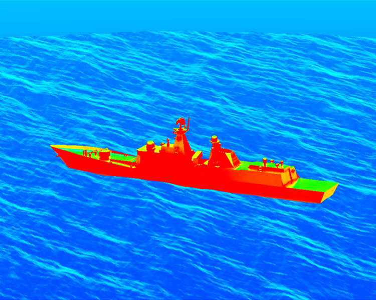
When Every Wave Looks the Same, So Does Your Training Data
Maritime artificial intelligence lives or dies on the data it learns from. An automatic target recognition (ATR) algorithm trained on a sea that never changes will eventually meet a sea that never stops changing. Wave crests shift, foam forms and dissipates, wakes cut across the scene, and the spatial variance missing from your training set suddenly becomes the dominant feature in your measured imagery. The result is a model that performed well in development and underperforms at the moment it matters most.
Why Sea Surface Variability Is a Training Data Problem, Not a Rendering Problem
Maritime detection and classification models learn from what they are shown. When synthetic training imagery is generated deterministically, the same inputs produce the same sea surface geometry every time, so wave crests and troughs land in the same places across an entire dataset. That consistency invites biased learning: the algorithm can latch onto fixed spatial structure that has nothing to do with the target.
Real imagery fed to a trained ATR algorithm will always include wave action and its associated spatial variance. For training imagery to be useful, that same phenomenology has to be present. This is not about making pictures look better. It is about whether the statistical world your model learned matches the statistical world it will operate in.
The Physics That Has to Be Right First
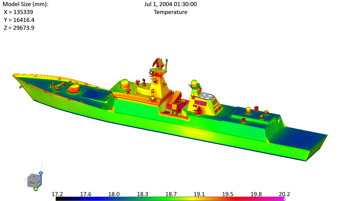
Variability is only valuable when it is physically grounded. MuSES calculates maritime object temperatures using a finite-volume (spatial), finite-difference (time) approach driven by transient weather data, including air temperature and wind speed, estimated or measured sky temperature, calculated or measured solar insolation, ship speed and heading, sea surface temperature, material properties, and thermal history.
Spectral optical surface properties are then combined with surface temperatures and surrounding scene components, such as other objects, sky, sun, and moon, to compute radiances from the perspective of a user-defined virtual sensor. Those sensor-detected radiances account for surface emission, reflection, atmospheric extinction, and path radiance using MODTRAN, developed by Spectral Sciences.
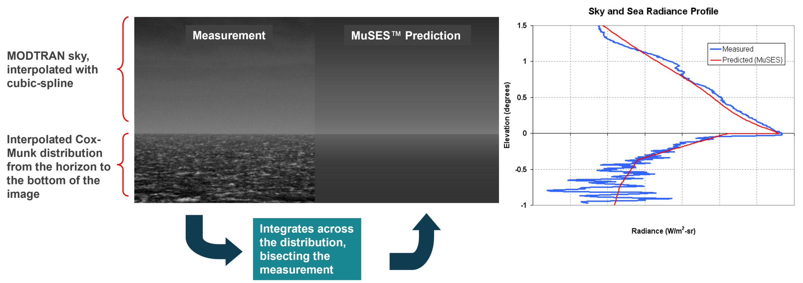
For the sea background itself, MuSES employs a Cox-Munk approach that combines large-scale gravity waves with statistical perturbations representing capillary waves. Four user-selectable frequency spectra, Pierson-Moskowitz, JONSWAP, Neumann, and Bretschneider, model gravity waves based on wind speed or sea state code.
Breaking waves and foam matter enormously in the infrared. Foam behaves much like a blackbody emitter in thermal wavebands while remaining highly reflective in the visible band. MuSES represents foam as a diffuse, slope-insensitive Lambertian source, in contrast with the specular Fresnel reflection model used for foam-free water. Foam coverage is driven by wind speed and, to a lesser extent, by air-sea temperature difference, and each sea surface facet carries area-weighted contributions of both clear water and foam.
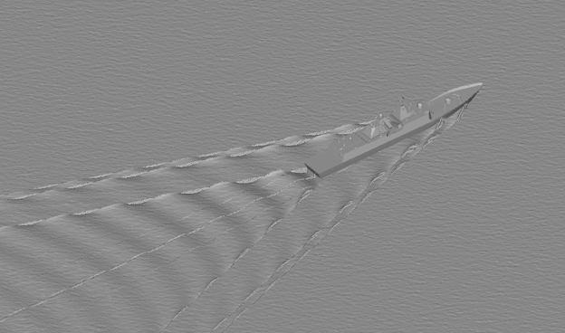
Ship wakes receive the same rigor. The MuSES Kelvin wake includes both divergent and transverse wave components and depends on vessel type, waterline length, stern width, draft, and displacement. Bow, stern, and turbulent wakes are also computed and integrated into the overall wake solution.
Unstructured and Structured Seas Serve Different Missions
MuSES provides two sea surface types.
The Unstructured sea is a geometry-less surface that applies the physics above to produce radiometric sea surface emissions and reflections influenced by wind and waves, without geometric facets. It captures wind, wave, and whitewater effects statistically rather than aesthetically, and it has been validated against measured imagery.
The Structured sea generates a geometry-based surface with varying wave slopes driven by sea state, wind speed, and wind direction. It is statistically similar to the Unstructured sea, and both have compared favorably against measured imagery, but the Structured sea looks more realistic to the human eye. It also provides the mechanism for ship reflections to influence what a sensor observes, which is exactly the interaction that matters when a hull, a wake, and a wave field are all competing to influence the same pixels.
Randomization: Same Inputs, Different Realizations
Historically, MuSES generated Structured sea surfaces deterministically using a frequency-domain method. The same inputs produced the same geometry, every time.
Starting in MuSES 2026.1, users can generate sea surface realizations that vary from one image to the next even when sea state and all other inputs are held constant. Wave crest and trough locations move across the dataset, introducing the spatial diversity an AI/ML training corpus needs without abandoning the physics that makes each frame defensible.
Deterministic generation has not gone away. A specified seed value reproduces a given radiance image from a given set of inputs, so verification runs, regression checks, and shared analysis across teams remain fully repeatable. Engineers get diversity when they want it and reproducibility when they need it.
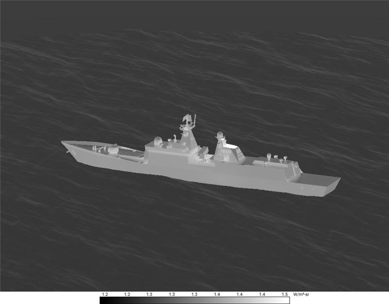
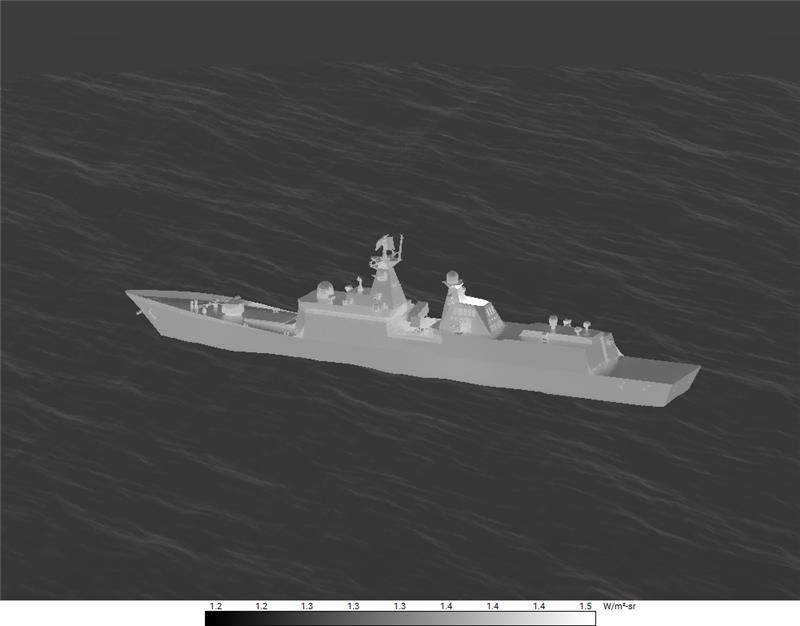
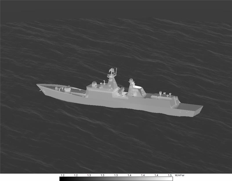
What This Enables for Signature and Detection Model Development
For signature management engineers and EO/IR modeling specialists, randomized Structured seas deliver training and evaluation imagery that represents the environment a sensor will actually encounter, including the background clutter that drives false alarms.
For teams developing ATR and other AI/ML detection models, it means a larger, more varied dataset built from physics-based simulation rather than repeated variations on a single scene.
For program and acquisition leaders, it means model performance claims rest on training data whose variability was engineered on purpose and can be explained, reproduced, and defended.
None of this replaces measurement. Field and range testing remain the ground truth against which these methods are verified, and MuSES sea surface models have been checked against measured imagery for exactly that reason. Simulation earns its place by extending the conditions you can examine, reducing expensive surprises, and letting your measured data go further.
Closing the Gap Between the Sea You Train On and the Sea You Operate In
The gap between idealized training data and real-world maritime variability is where detection performance quietly erodes. Randomized sea surface generation in MuSES closes that gap by making variability a first-class, physically grounded input rather than an artifact you hope the algorithm ignores. That is infrared signature simulation for critical defense applications, and it is what engineering confidence looks like when the mission depends on what your sensor sees, and what an adversary’s does not.
Ready to talk through how randomized sea surfaces fit your maritime signature or AI/ML training workflow? Our engineering team will work shoulder-to-shoulder with yours to implement this feature into your workflow.